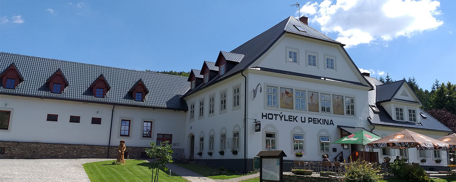

Cycling trails
There are built over 200 km of marked cycle routes. The routes pass picturesque valleys, mountain streams and along the ridges of steep hills with nice views, trails lead mostly along local and forest paths, sometimes along third-class roads. On routes are good signs, rest areas are equipped with indicative signs with information about the places through which currently driving.
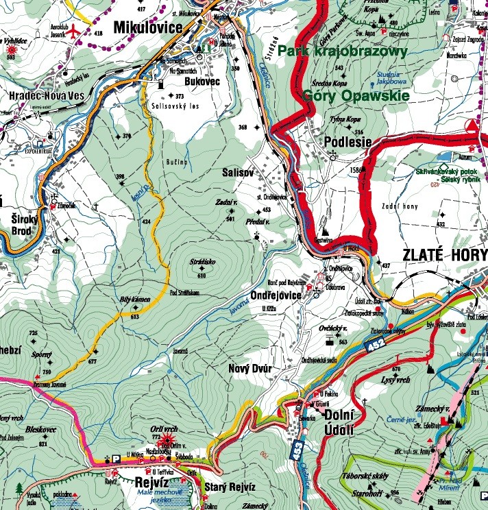
TOUR NO. 1
Mikulovice | Terezin | Vel. Kunetice / Slawniowice | Great Kunetice | Vel. Kunetice hosp. | (k Frantisek) | Supíkovice | Supíkovice hosp. | Sand quarry | Sandy railway station. | Sandy | Cold Zejf | Wide Brod | Mikulovice
Length: 20.2 km, elevation 130 m
Along the route such as "wagon" 0.2 km (1%) | "The road III.class / MK" 4.1 km (20%) | "Road II. Class" 10.3 km (51%) | "Main road" 5.6 km (28%), 1.5 km (11%) | "Road II. Class" 6.4 km (46%)
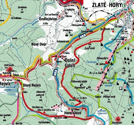
ROUTE NO. 2
Mikulovice | Ondřejovice railway station. | Lower Valley | Rejviz | Rejviz grove. | Rejviz crossroads. | (under the contested) | (under the white stone) | (under Stražisko) | Mikulovice
Length: 27.5 km, elevation 490 m
Along the route such as "forest / field" 7.3 km (27%) | "The road III.class / MK" 3.8 km (14%) | "Road II. Class" 16.4 km (60%)
ROUTE NO. 3
Ostružná | Ramzová | Upper Lime | (u Chiranka) | Lime Spa | Better. Spa zast. | Bobrovník campsite | Jesenik | Jesenik railway station. | Water fortress | Czech Ves | Czech Ves baz. | Distillers | Sandy | Sandy railway station. | Nová Ves | Aeroclub Jesenik | Mikulovice | Mikulovice / Glucholazy | Glucholazy
Route length 33.3 km, elevation 470 m
Along the route type :: "forest / field" 1.8 km (5%) | "Wagon" 0.6 km (2%) | "The road III.class / MK" 9.8 km (29%) | "Road II. Class" 10.9 km (33%) |"Main road" 10.2 km (31%)
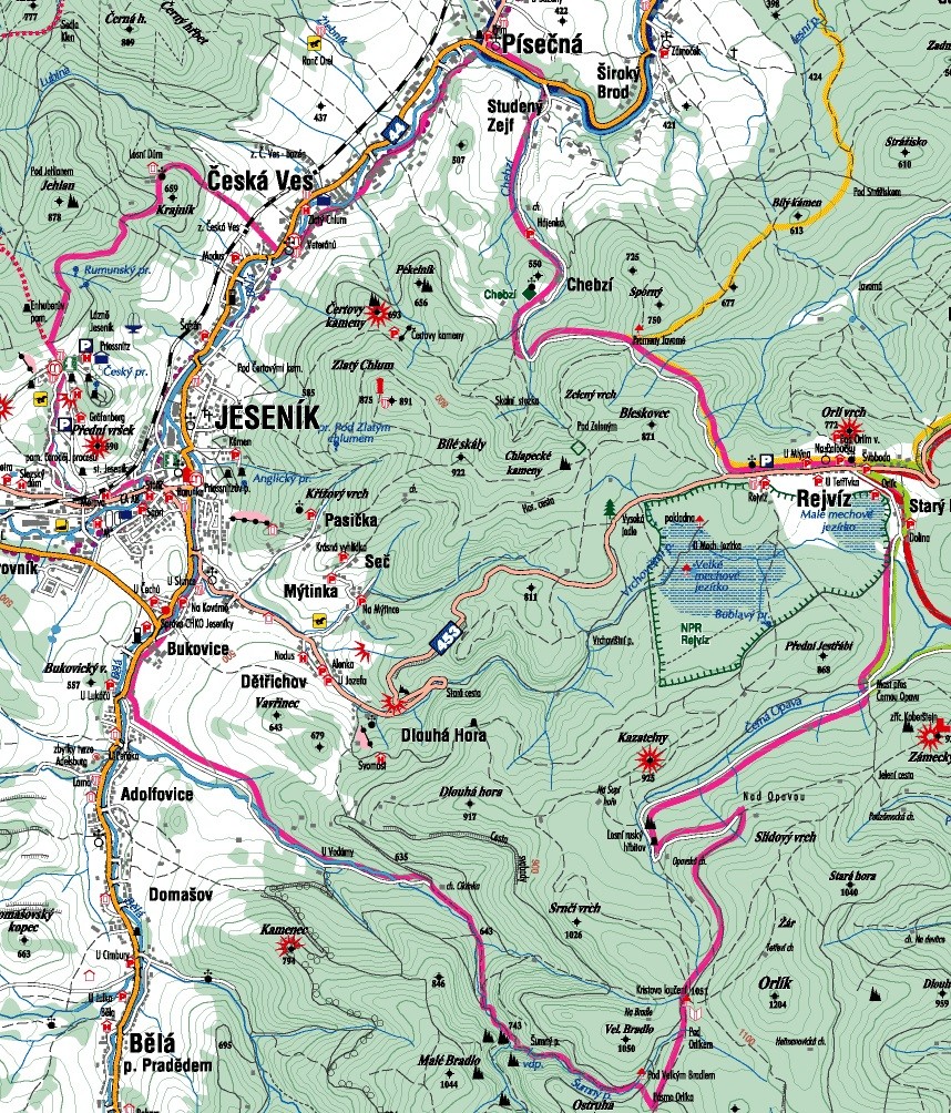
ROUTE NO. 4
Sandy | Cold Zejf | Chebzí | Chebzí grove | (under the contested) | Rejviz crossroads. | Rejviz grove. | Rejviz | Old Rejviz | Bridge over the Black Opava | Opavská hunting lodge | Under Orlik - creek | Band Orlíka | The Big Bradl | Šumný creek | For the waterworks | Adolfovice - Bridge |Adolfovice | Adolfovice - Bridge | Bukovice (u Jesenik) | Jesenik - cars. tank. | Jesenik | Jesenik - nem. | (at the station) | Jesenik railway station. |Preissnitzovy Spa | Revolutionary Slavic | Spruce Stream | Forest House crossroads. | Forest House | (under stones) | Czech Ves | Sandy
Length: 47.8 km, elevation 670 m
Along the route such as "Walking" 1.7 kilometers (3%) | "Forest / field" 5 km (10%) | "Wagon" 17.55 km (37%) | "The road III.class / MK" 15.7 km (33%) | "Road II. Class" 2.4 kilometers (5%) | "Main road" 5.45 km (12%)


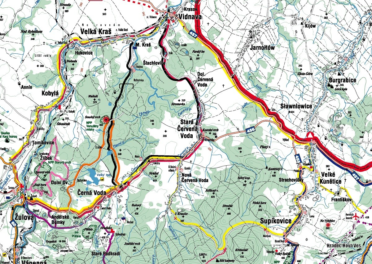

ROUTE NO. 5
Great Kunetice | Vel. Kunetice / Slawniowice | View | Dol. Worm. Water / Jarnóltow | Vidnavské Fojtství | Vidnava | Vidnava railway station. | Little Beauty | Great beauty railway station. | Little Beauty | Great Beauty | Hukovice | Kobylá Lock | Kobylá railway station. | Kobylá Lock | Kobylá over VIDNAVKOU | Tomíkovice | Granites. benz. | Granite | (the mayor) | (the Angelic lodges) | (to Lower Court) | (for more expensive) | Black Water |Black Water intentions. | Gorges | N. Red Water grove | Supíkovice hosp. | Supíkovice | Strachovičky | Palus | Great Kunetice
Length: 42.8 km, elevation 330 m
Along the route such as "wagon" 0.4 km (1%) | "The road III.class / MK" 21.4 km (50%) | "Road II. Class" 18.6 km (43%) | "First class road '2.4 km (6%)
ROUTE NO. 6
Zlate Hory | Zlate Hory grove. | renounce. Chapel St. Marty | (under the Castle hill) | Old Rejviz | Rejviz | Lower Valley | Zlate Hory
Length: 23.7 km, elevation 380 m
Along the route such as "forest / field" 6.4 km (27%) | "Wagon" 2.5 km (11%) | "The road III.class / MK" 4.6 km (19%) | "Road II. Class" 10.2 km (43%)
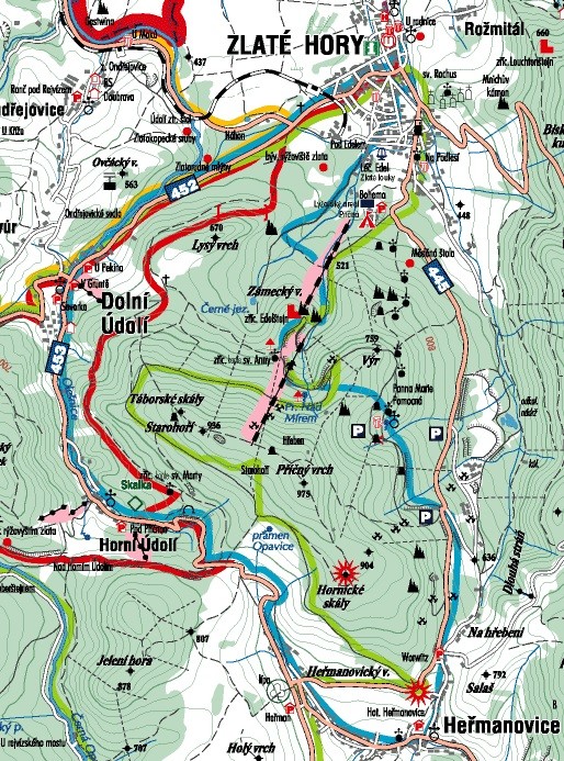
ROUTE NO. 7
Zlate Hory | Zlate Hory | (beneath the Castle vr.) | Edelštejn | St. Anna | Virgin Mary | (u Zlatorudné gallery) | Hermanovice | (under spring Opavice) | Upper Valley | Lower Valley | Zlate Hory
Length: 22.3 km, elevation 400 m
Along the route such as "Walking" 0.9 km (4%) | "Wagon" 3.3 km (15%) | "The road III.class / MK" 1.5 km (7%) | "Road II. Class" 16.6 km (74%)
ROUTE NO. 8
Zlate Hory | Zlate Hory | (beneath the Castle vr.) | Edelštejn | St. Anna | (below the cutout) | (under heat) | Dragons | (under Koberštejnem) | Old Rejviz | Rejviz | Lower Valley | Zlate Hory
Length: 34.9 km, elevation 470 m
Along the route such as "wagon" 14.8 km (42%) | "The road III.class / MK" 6.6 km (19%) | "Road II. Class" 13.5 km (39%)